The central part of the Keno Hill Silver District is host to over 100 million ounces of past production and current Indicated resources in shallow deposits that to date have not previously seen systematic exploration to depth or along strike. Central Keno was one of the original discovery areas in the region and hosted the historic producing Keno Hill mine, along with 8 other high-grade deposits including those on Metallic Minerals land holdings. Metallic Minerals’ work to date in this area shows the presence of a major structural corridor that is comparable in surface expression and structural setting to the +150 million-ounce Bermingham-Calumet system in the more extensively explored western part of the district.
Caribou Target Area
The Caribou target in the central part of the district is one of the most advanced individual targets at the Keno Silver Project. The Caribou deposit historically produced very high-grade material grading more than 1,000 g/t silver from near surface and is interpreted to be a significant connecting structure between the main shear structures in the Keno Summit structural corridor. The Caribou deposit spatially occurs within a high-level silver-in-soil anomaly of over 10 g/t AgEq that extends over 2.5 km long by 1.5 km in width and that remains open to expansion.
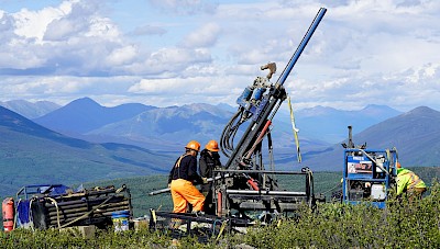
As part of the exploration program in 2021, Metallic Minerals completed the first-ever application of deep-sensing IP geophysics on the Keno Silver project using Simcoe Geoscience’s Alpha IPTM system. Two deep-looking IP lines were completed across the Central Keno area, which identified significant conductive features that spatially correspond with the newly mapped regional scale thrust fault structures and associated epithermal style silver mineralization. This IP survey in combination with the drilling and detailed mapping has allowed the Metallic Minerals technical team to identify major conductive features that are spatially associated with kilometer-scale soil and magnetic anomalies and significant silver mineralization. This combination of utilizing drilling, geophysics and soil sampling is a highly effective tool set for targeting mineralization across the Keno Hill silver district.
Figure 2 – Caribou Vein Long Section

Drilling in 2021 returned significant step out extensions of mineralization from the main Caribou deposit to the north, south and down dip. Eight of these holes intersected continuous mineralized zones from 15 to 64 m width including a 400-meter step out that encountered 15.2 m grading 97.2 g/t AgEq with 1.5 m grading 628 g/t AgEq (500 g/t Ag, 0.13 g/t Au, 2.35% Pb, 0.45% Zn). This zone appears to be spatially associated with the location of one of the newly mapped regional thrust faults that can host high-grade epithermal silver mineralization. The high-level silver-in-soil anomaly continues for another 1.5 km to the south along strike from this southernmost drill hole at Caribou.
Homestake
The historically productive Homestake target is located south of the Keno Summit target area along a parallel structural corridor. The style of the Homestake structure is comparable to those seen at the Keno Summit and in the more developed Western Keno areas. Homestake is comprised of two parallel vein structures within a broad structural corridor over 200 meters wide that has a demonstrated strike length of over 1 km in the host Keno Hill quartzite. Homestake #1 vein shows classic Keno-style, high-grade silver-lead-zinc mineralization, while the #2 vein can also show high gold grades with silver, which is characteristic of some structures in the larger deposits within the Keno Hill Silver District. The highest grades to date include assays of 4,027 g/t silver from drilling and 4,717 g/t silver from trenching on the Homestake #1 vein, and 22.1 g/t gold with 332 g/t silver from trenching on the Homestake #2 vein Prior drill results from Homestake can be found here.
To date there are 21 drilled vein intersections grading more than 600 g/t silver equivalent on the Homestake structures, including five that exceed 10 g/t gold on the Homestake #2 structure. Work in 2021 at Homestake focused on wide-spaced reconnaissance drilling along the main trends as well as extension of the open-ended soil anomalies. The soil sampling work expanded the high-level silver-in-soil anomaly associated with the Homestake mineralized system to 3 km in length by 1.5 km in width with the anomalies still open to further expansion. Intersections of anomalous silver over significant widths indicate a strike length of 1.5 km for the Homestake system. The next phase of systematic testing of these structures will be designed to delineate areas of the high-grade and bulk-tonnage toward development of an initial resource at Homestake.